Sona Mounds (Movilele de la Sona)
Eight steep earthen cones punctuate a pasture above the Olt Valley near Șona, their crisp alignment stirring debate among geologists, archaeologists, and village storytellers.
On the terrace above the Olt River in Brașov County, a pasture outside the village of Șona is punctuated by eight striking earthen cones. Known locally as the Movilele de la Șona, these grassy mounds rise sharply from otherwise level ground, forming an arresting pattern that has puzzled researchers and inspired folklore in equal measure. Whether seen from the village lanes or from the distant slopes of the Făgăraș Mountains, the silhouettes of the mounds are unmistakable—quiet, geometric interventions in a broad agricultural plain.
Eight Cones on the Olt Terrace
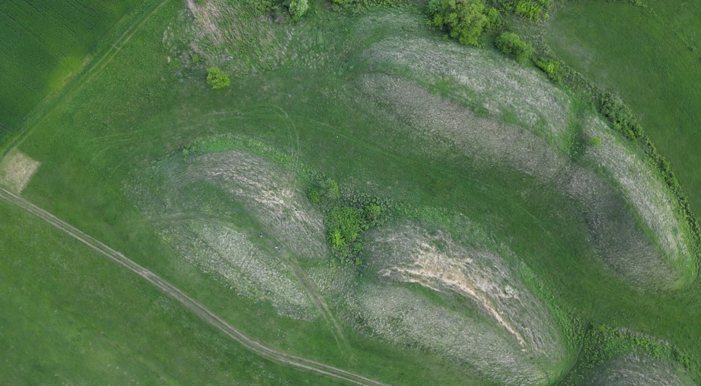
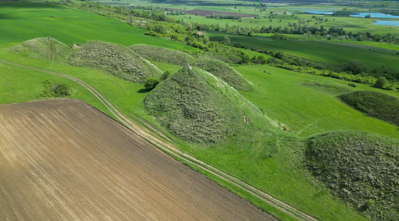
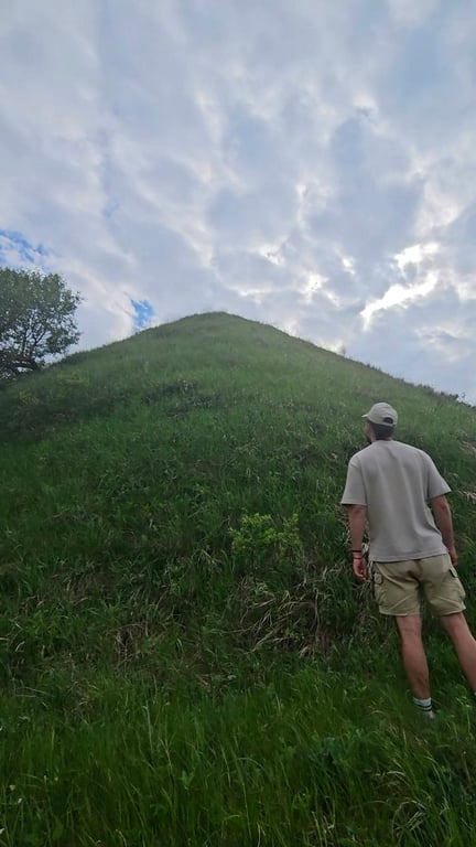
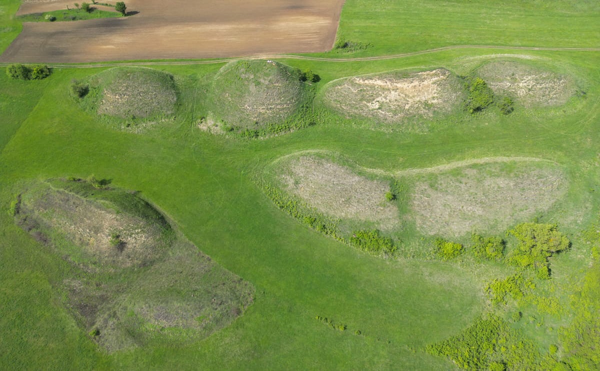
The Șona Mounds are arranged roughly in two parallel lines, a layout that becomes clearest when viewed from the southern edge of the pasture or from aerial imagery. Individual mounds stand several meters high—some approaching 8–10 meters—and span tens of meters at the base. Their sides are notably steep, with smooth, consistent slopes suggestive of careful shaping or sustained natural processes. In dry light the cones read as crisp forms; after rain they reveal subtle rills and soil color changes that hint at their internal composition.
Debate on Origin: Dune Field or Tumulus Row?
Scholarly opinion remains divided on how the Șona Mounds formed. One school proposes they are relict aeolian (wind-shaped) dunes, sculpted from loess and sands lifted off the Olt floodplain during drier climatic phases. The mounds’ granular soils and the presence of other low relief dunes along the valley lend credence to this view. Another line of thought sees the cones as anthropogenic: a planned field of tumuli or marker mounds, potentially Bronze or Iron Age, aligned to a route across the valley terrace. The tidy two-row arrangement and the consistent cone profiles are often cited as circumstantial evidence for deliberate construction. To date, however, no extensive, peer-reviewed excavations have been published, and the question remains open.
Folklore of Giants, Huns, and Dropped Aprons
Local stories add their own explanations, told on evening walks past the pasture. Some say giants were ferrying earth in aprons to build a fortress in the Făgăraș foothills when a storm scattered their loads. Others link the mounds to the passage of Huns or Tatars, imagining each cone as a commander’s grave or a hurried beacon. These legends, layered over centuries of retelling, reflect the mounds’ prominence in the local landscape as much as any historical event, keeping the site alive in community memory even as scholars weigh the evidence.
Reading the Landscape
Stand between the rows and the geometry frames the horizon: the Făgăraș ridge to the south, the Olt meanders to the north, and the web of old field boundaries underfoot. Whether natural or man-made, the cones occupy a strategic position—above floods yet within sight of fertile bottomlands and traditional routes. This liminal placement may explain their endurance, preserved by pastoral land use and the relative inutility of their steep flanks to modern farming.
Visiting the Mounds
The pasture lies just outside Șona village in the Țara Făgărașului region. Access is by farm track and short footpaths; there is no formal visitor infrastructure or on-site interpretation. Early morning and late afternoon light accentuate the forms and cast long, readable shadows that reveal the two-row plan. Wear sturdy shoes, respect crops and fences, and avoid climbing the steepest faces to reduce erosion. The site rewards an unhurried circuit around the cones—and, if the air is clear, a lingering look toward the snow-streaked Făgăraș Mountains.
Seen by few beyond the region, the small grassy knolls near Șona have accumulated rumors, half-remembered field notes and speculative footnotes in excavation reports. Beneath their modest silhouettes lie questions that academic summaries often ignore: odd soil textures, late-night stories told by shepherds, and hypotheses that tiptoe between folklore and hard science. This piece gathers the unconventional, lesser-known angles that invite curiosity rather than tidy conclusions.
Footnotes in the Earth: Traces Scholars Sidestep
Several local surveys mention anomalous soil layers under the mounds—charcoal lenses, compacted clay bands and concentrations of fragmented pottery shards—that never made it into high-profile publications. Some fieldworkers recorded small postholes at the bases of certain hummocks, hinting at wooden structures once attached to the earthworks. These tiny observations suggest intermittent human activity rather than a single construction event, but because finds have been limited and unpublished, they sit like marginalia in the archaeological record.
The Forgotten Test Pits
Amateur archaeologists and farmers who permitted shallow test pits have sometimes found concentrations of burned bone and metal slag. These ad hoc discoveries are seldom followed up with formal excavation, leaving tantalizing but unverifiable clues about whether the mounds were used for cremation, craft workshops or agricultural processing.
Night Whispers from the Earth
Local oral tradition wraps the mounds in a cloak of uncanny phenomena. Residents tell of low, windless nights when a faint, bell-like resonance seems to emanate from the hillocks, and of glows that appear and vanish shortly before dawn. Such sensory reports—dismissed as natural gas, bioluminescence or imagination by skeptics—persist in village memory and have spawned a small subculture of night visitors hoping for the inexplicable.
The Treasure-Shepherd's Oath
A recurring tale speaks of a 19th-century shepherd who swore he dug into a mound and found a cache of coins before being frightened off by a chorus of voices. Versions differ on whether the coins were ancient or merely Ottoman-era, but the story has hardened into a local taboo: do not disturb the mounds if you value peace of mind.
Blueprints or Bedlam? Controversies That Refuse Resolution
Debate lingers over whether the mounds are deliberately arranged according to lost patterns or merely the product of incremental human and natural processes. Some fringe researchers have proposed that their spacing encodes calendrical information or landscape surveying practice, while others argue for accidental placement related to past plowing boundaries or livestock enclosures. The lack of systematic geophysical surveys keeps these arguments alive without resolution.
Kurgan Echoes or Coincidence?
Comparative theorists have noted a superficial resemblance to steppe kurgans and small burial mounds found across Eastern Europe, suggesting cultural transmission or convergent ritual behavior. Yet no inhumations or grave goods have been reliably reported, leaving the kurgan parallel provocative but unproven.
A Web of Lonely Hills: Unexplained Links Beyond Șona
Researchers with an eye for landscape patterns have pointed out clusterings of similar minor mounds across the region—sometimes aligned with old footpaths, water sources, or distant ridgelines. Could these knolls be waypoints, territorial markers, or an echo of an older communication network now invisible to maps? The tantalizing possibility is that Șona is one node in a dispersed system whose logic has been largely erased.
The Mapmakers' Puzzle
Old cadastral maps and travelers' journals occasionally show tiny notations where the mounds stand today; whether those marks recorded sacred places, land claims, or mere field irregularities is an open question. For open-minded seekers, the mounds remain a place where small observations compound into larger mysteries—if only someone will look closely enough.
Sona Mounds (Movilele de la Sona) — photo gallery