El Boqueron Volcano
A dramatic volcano crater hosting a smaller cone within, offering stunning views and a glimpse into the raw power of nature near San Salvador.
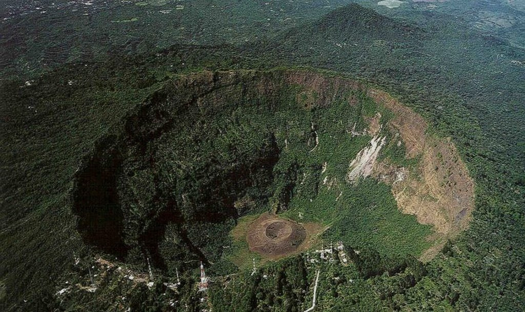
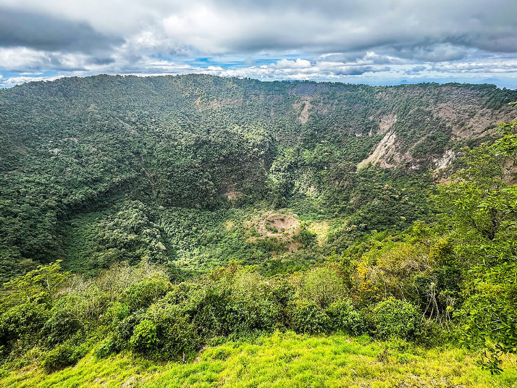
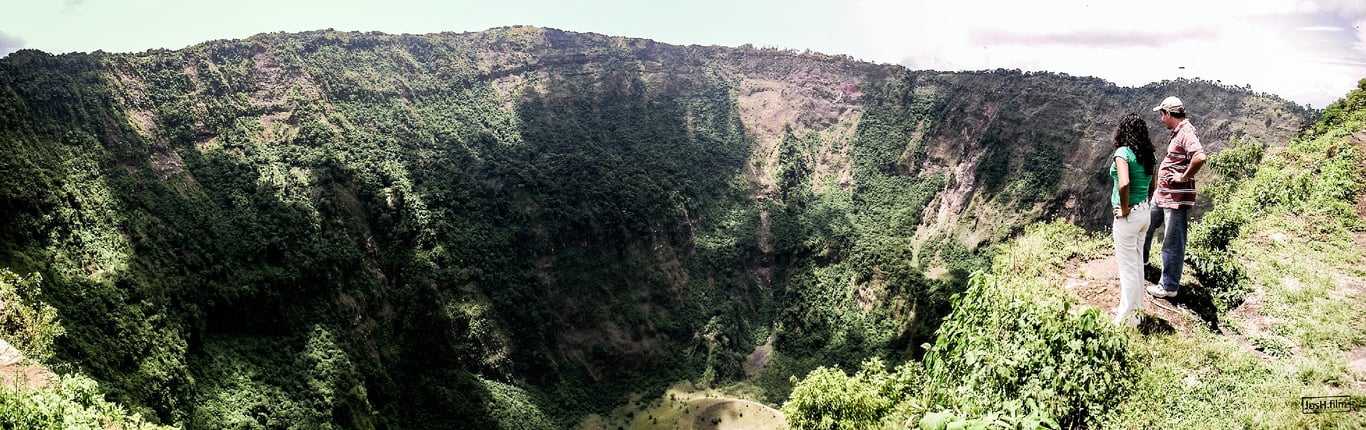
Looming over the cityscape of San Salvador, the El Boquerón Volcano is a commanding presence and a testament to the geological forces that have shaped Central America. Its name, translating to "big mouth," aptly describes the massive crater, nearly 1.5 kilometers in diameter and 500 meters deep. Visitors who make the journey to its summit are rewarded with breathtaking panoramic views, not only of the sprawling metropolis below but also of the unique volcanic feature nestled within the main crater: a smaller cinder cone, also named 'Boqueroncito'.
The Crater Within a Crater
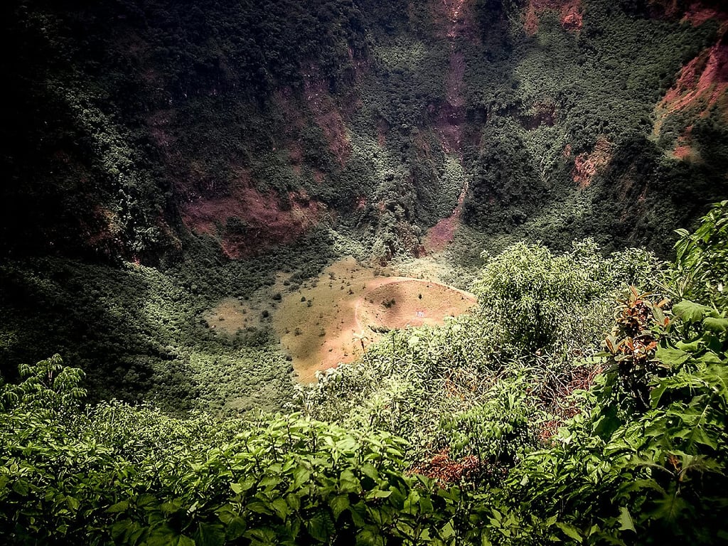
The most striking feature of El Boquerón is its nested structure. The main caldera, a vast and imposing depression, was formed by colossal eruptions centuries ago. But the star of the show is Boqueroncito, the "little mouth," a perfectly formed cone that emerged from the crater floor during the volcano's most recent major eruption in 1917. This geological anomaly provides a fascinating, textbook example of volcanic activity. The steep, verdant walls of the main crater plunge dramatically to the floor, creating a stark contrast with the dark, younger cone at its heart. The scale is immense, and the air at the rim carries a crisp coolness, a welcome respite from the city's heat.
A History of Fire and Rebirth
El Boquerón's history is one of cyclic destruction and regeneration. The volcano has been active for tens of thousands of years, but its most socially significant recent event was the 1917 eruption. This event dramatically altered the landscape and the lives of those nearby. The eruption vaporized a crater lake that had previously existed within the main caldera, forcefully ejecting ash and rock and creating the Boqueroncito cone that stands today. Lava flows from this eruption, though not extensive, served as a potent reminder of the volcano's power. Ash fell on surrounding communities, forcing evacuations and impacting agriculture.
From Devastation to National Park
In the century since its last major eruption, nature has reclaimed much of El Boquerón. The slopes are now covered in a rich cloud forest ecosystem, and life has returned to the crater's interior. Recognizing its importance, the area was declared El Boquerón National Park (Parque Nacional El Boquerón). A well-maintained series of trails and viewpoints allows visitors to walk along the crater's rim, offering different perspectives of Boqueroncito and the surrounding landscape. The park is a popular destination for both Salvadorans and international tourists, who come for the stunning vistas, the invigorating hikes, and the opportunity to stand on the edge of a dormant, but not extinct, volcano. The area is also home to diverse flora and fauna, adapted to the high altitude and volcanic soil, making it a point of interest for nature lovers and biologists alike.
The Untold Secrets of El Boquerón Volcano
Most visitors snap photos from the rim and descend with postcards of a perfect crater. But El Boquerón's true character lives in odd echoes, half-remembered stories and small traces that rarely make it into guidebooks. For those willing to look beyond panoramic vistas, the volcano becomes a palimpsest of ritual traces, strange sounds, and speculative lines that stitch it into a much larger, unsettled landscape.
Secrets the Crater Keeps at Dawn
Before the park signs and paved trails, the slopes of Boquerón were trodden by people whose marks are now faint. Local antiquarians occasionally report pottery fragments and worked stone along lesser-used gullies—finds never fully excavated or published. Some historians point to colonial-era references to "altars on the heights" near San Salvador; whether those altars sat on Boquerón's rim or on neighboring peaks remains a debated whisper among specialists.
Echoes of High-Place Offerings
Oral fragments collected from cantinas and elderly farmers speak of small offerings—corn, tobacco, wrapped bundles—left on isolated rocks at dawn. These acts are often dismissed as modern syncretic vestiges, but they raise the question: did pre-Hispanic communities treat the crater as a liminal site for skyward rites? The archaeological record is tantalizingly thin, leaving room for speculation.
Whispers in the Fog
Local folklore cloaks Boquerón in spectral imagery. On misty evenings guides tell of a pale figure walking the rim, a shapeshifting woman who appears to those alone at dusk. Such tales mesh with national legends—the Siguanaba and other cautionary apparitions—but Boquerón’s versions are peculiarly site-specific, referencing a stone bench "that was never carved" and a sudden, unnatural hush.
The Woman Who Steps Between Worlds
Stories say travelers who answer the woman's call find themselves disoriented, sometimes hours of walking reduced to minutes on watches. Whether these are moralizing tales warning against night travel or memories of real disorienting atmospheric phenomena, they persist as a local rite of storytelling, binding community memory to the crater's edge.
The Ash-Masked Alignments
Fringe researchers and amateur surveyors have long loved volcanoes for their clear horizons. Around Boquerón a persistent, unofficial theory holds that the crater rim contains markers aligned to solstitial sunrise points and to other regional peaks. Professional archaeologists urge caution: the volcanic landscape shifts and human-made markers erode. Yet the pattern-spotting continues, fueled by maps, compass bearings and a hunger for cosmic purpose.
Acoustic Oddities and the Low Hum
Visitors sometimes report an odd low-frequency rumble or a metallic ringing on windless mornings—phenomena geophysicists can attribute to infrasound and pressure differentials in volcanic topography. For the open-minded, these sounds read like a subterranean conversation: geological voices that provoke stories of hidden chambers or restless spirits beneath the ash.
Ridges That Talk to Distant Craters
Finally, there is a cartographic itch: lines drawn between Boquerón, Coatepeque, and lesser-known mounds form axial patterns that some claim map an ancient ritual network across El Salvador’s volcanic spine. These connections are speculative, but they invite rethinking of the crater not as an isolated spectacle but as a node in a territory richly woven by people, myths and the earth's restless architecture.
The Joya Line Theory
Proponents of a "Joya Line" suggest sightlines link Boquerón with Joya de Cerén and other inhabited valleys, possibly for seasonal signaling or pilgrimage. The idea remains unproven—yet it persists, a reminder that landscapes often keep their most provocative stories just out of reach, available to those who come with curiosity and a notebook.
El Boqueron Volcano — photo gallery